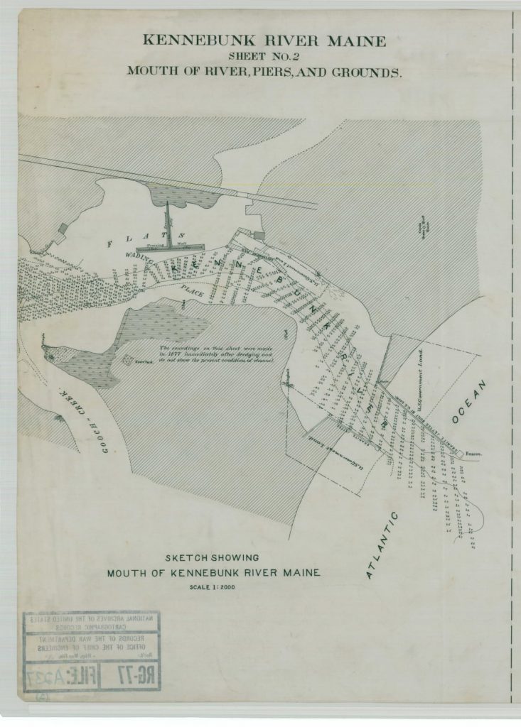
Government Wharf, Piers, and Boathouse Jetty on the Kennebunk River
The Kennebunk River was not originally suitable for shipbuilding or even navigation of merchant vessels, for that matter. A large ledge called Perch Rock obstructed the east side of channel. At low tide, only 10 inches of water passed over a sandbar across the mouth of the river. Shifting sands were liable to change the location and configuration of the channel during every storm. Local businessmen and the Federal Government made numerous improvements to navigation on the Kennebunk River that we take for granted today.
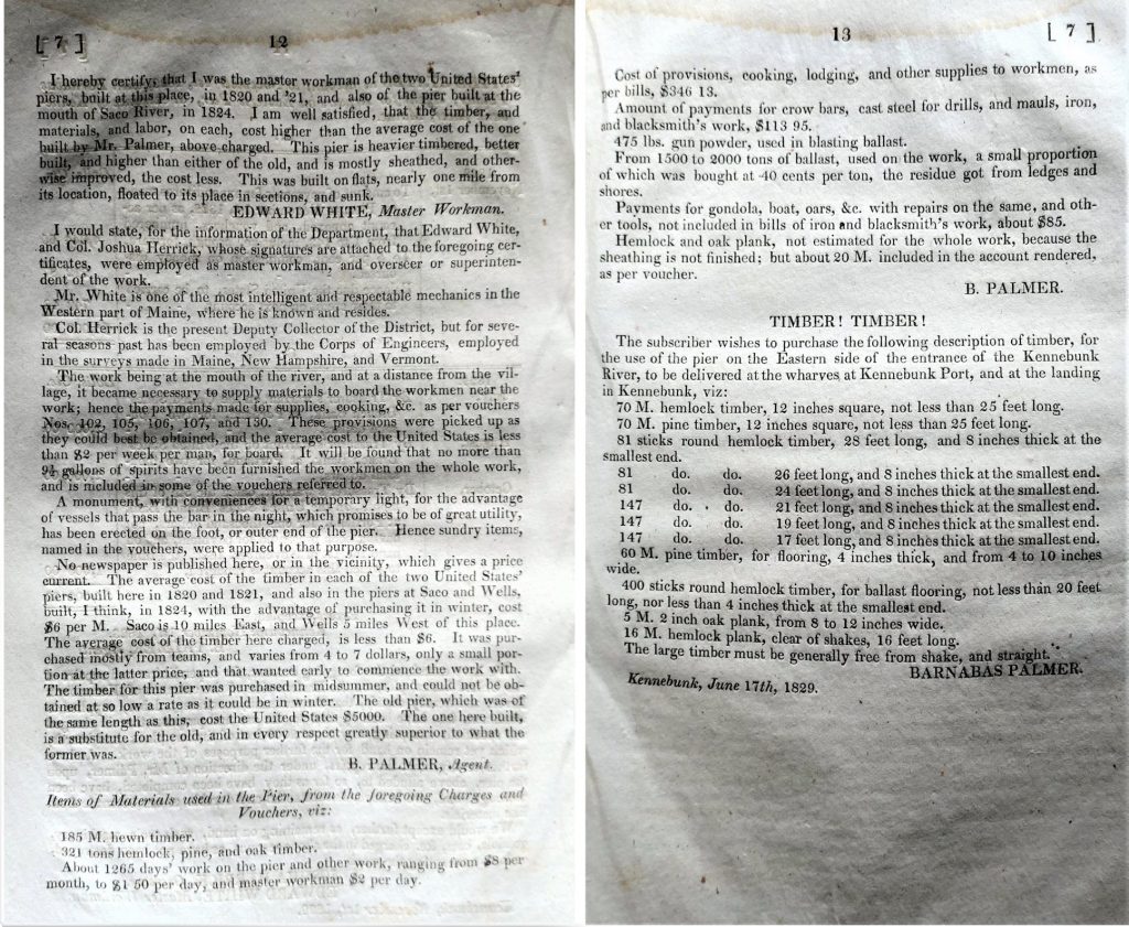
In 1793, local merchants led by Tobias Lord, Oliver Keating, and Thatcher Goddard, invested $3,000 of their own money to erect a pier extending from the eastern riverbank over Perch Rock. After a few years it became apparent that not only had Perch Rock Wharf prevented ships from striking the dangerous ledge, but it had kept the location of the channel constant during storms and diminished the sandbar. The businessmen petitioned congress to allow them to recoup their investment by imposing a tonnage duty on vessels entering the river.
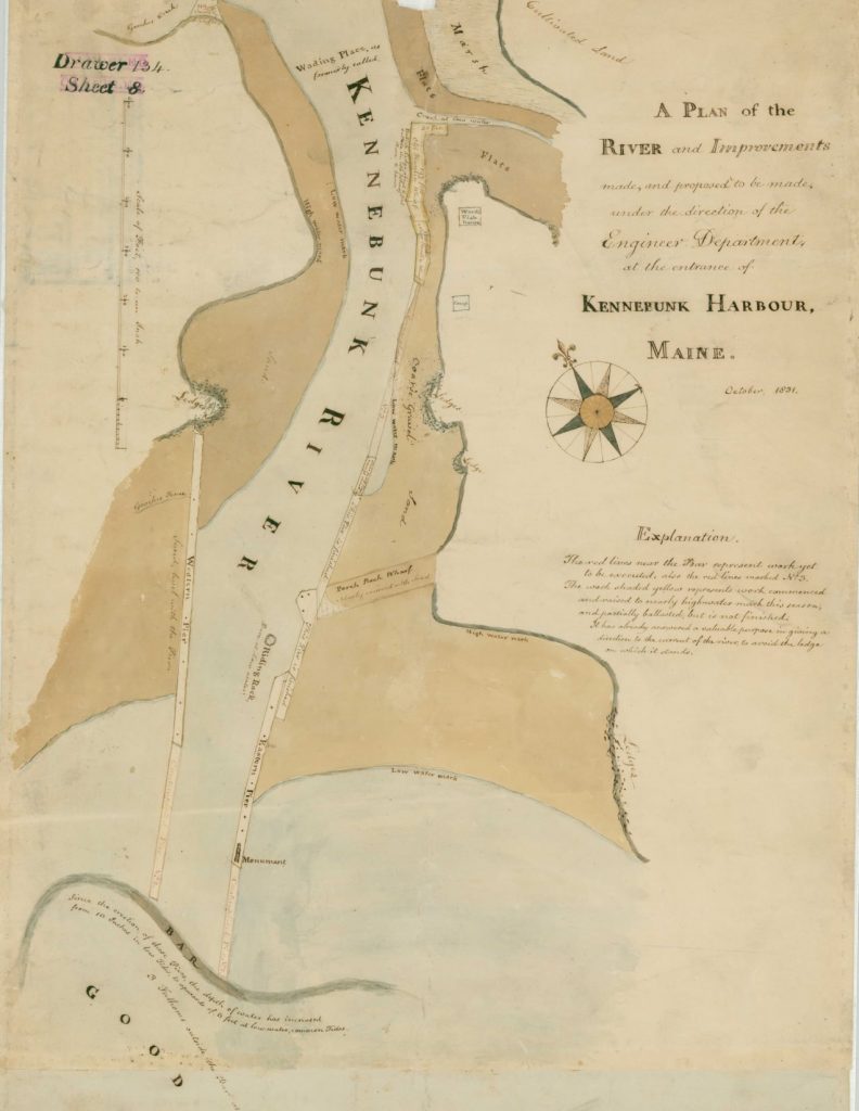
To enhance the success of Perch Rock Wharf, local men petitioned Congress to build a pier on the western side of the mouth of the Kennebunk River. Congress appropriated $5,000 in 1820 with which land was purchased from Samuel Gooch and the first western pier was built of pine timber cribs filled with small stones. Congress appropriated another $4,000 the following year to build an eastern pier a bit downstream from Perch Rock Wharf.
Within three or four years both wooden piers were thoroughly honeycombed by sand flea larvae. If the compromised woodwork was allowed to give way, the rock ballast would fall into the channel and render entrance into the harbor more difficult than ever before. To make matters worse, the eastern pier was seriously injured by a storm in 1828. Another $5,000 was appropriated by congress “for replacing the injured portion of the western pier with a work of stone and for strengthening and extending inward the pier on the east side of the river.
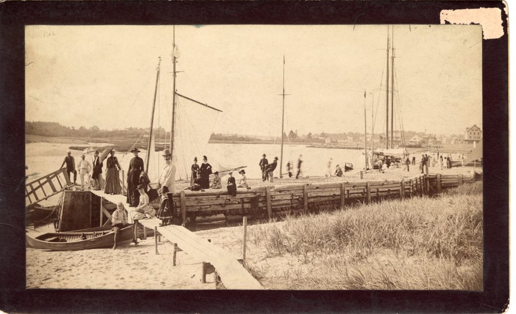
The 1829 work order included an extension of privately owned wharves, forming a substitute for that portion of the old eastern pier which had been destroyed by worms and storms. It took until 1831 to complete the project that included the purchase of “Granny Hardin’s Wharf” on the east side of the river. Government Wharf was built around Granny Harding’s wharf. It is now an active commercial fishing wharf.
Repairing the infested wooden piers at the mouth of the river proved futile. The government went in search of local granite as a more permanent building material. In 1836, a project to replace most of the wood with granite quarried off Beachwood Road commenced. The local granite proved to be of exceptional quality and a robust quarrying Industry was born in Kennebunkport.
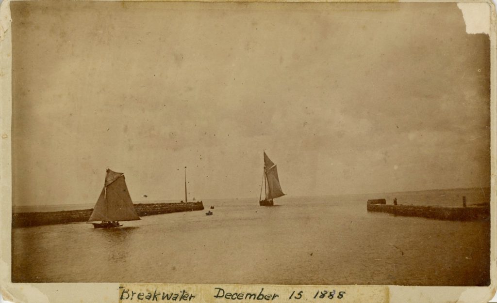
From 1856 to 1859 a wooden lighthouse perched at the end of the eastern stone pier. It was a square wooden structure painted white with a 6th order lens showing a fixed red light mounted 21 feet above high water. The eastern pier lighthouse was illuminated for the first time on the evening of January 1, 1857. It was permanently extinguished two years later because mariners kept confusing it for Goat Island Light in Cape Porpoise. The square lighthouse building was destroyed in a storm before 1870.
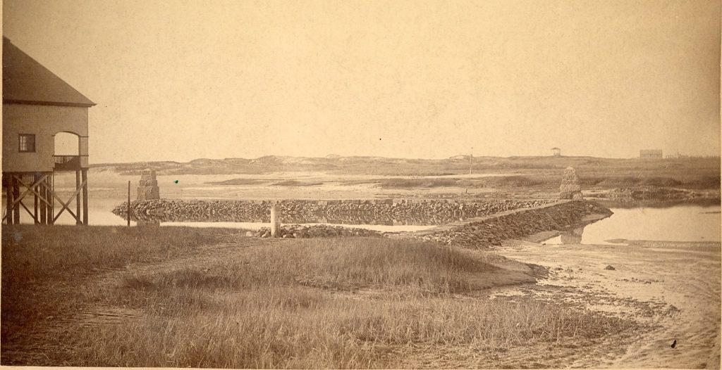
The government repaired the granite piers and Government Wharf many times over the years. Repairs to both were proposed in 1889 a year before the Kennebunk River Club Boathouse was built. Also included in the proposal that year was a new two-winged jetty and retaining wall projecting from the eastern riverbank across Fairfield Creek from Government Wharf. The boathouse was built there in 1890 and the government jetty was completed in 1891 with a single wing.
Many thanks to the National Archives for making digital copies of so many of the government project maps and lighthouse plans available online!
Leave a Reply