Attention Map Lovers
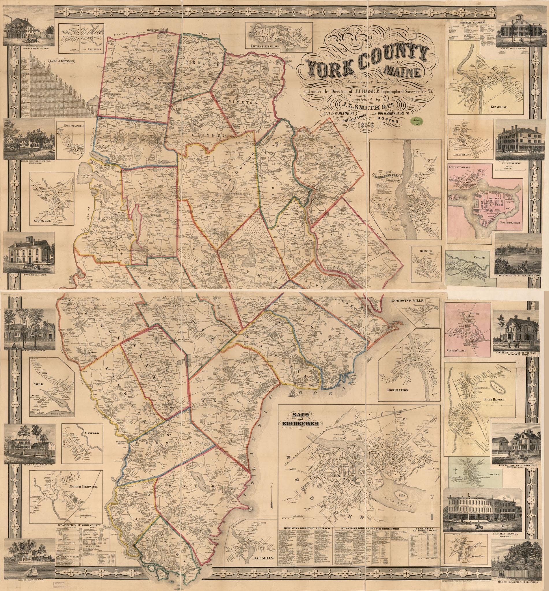
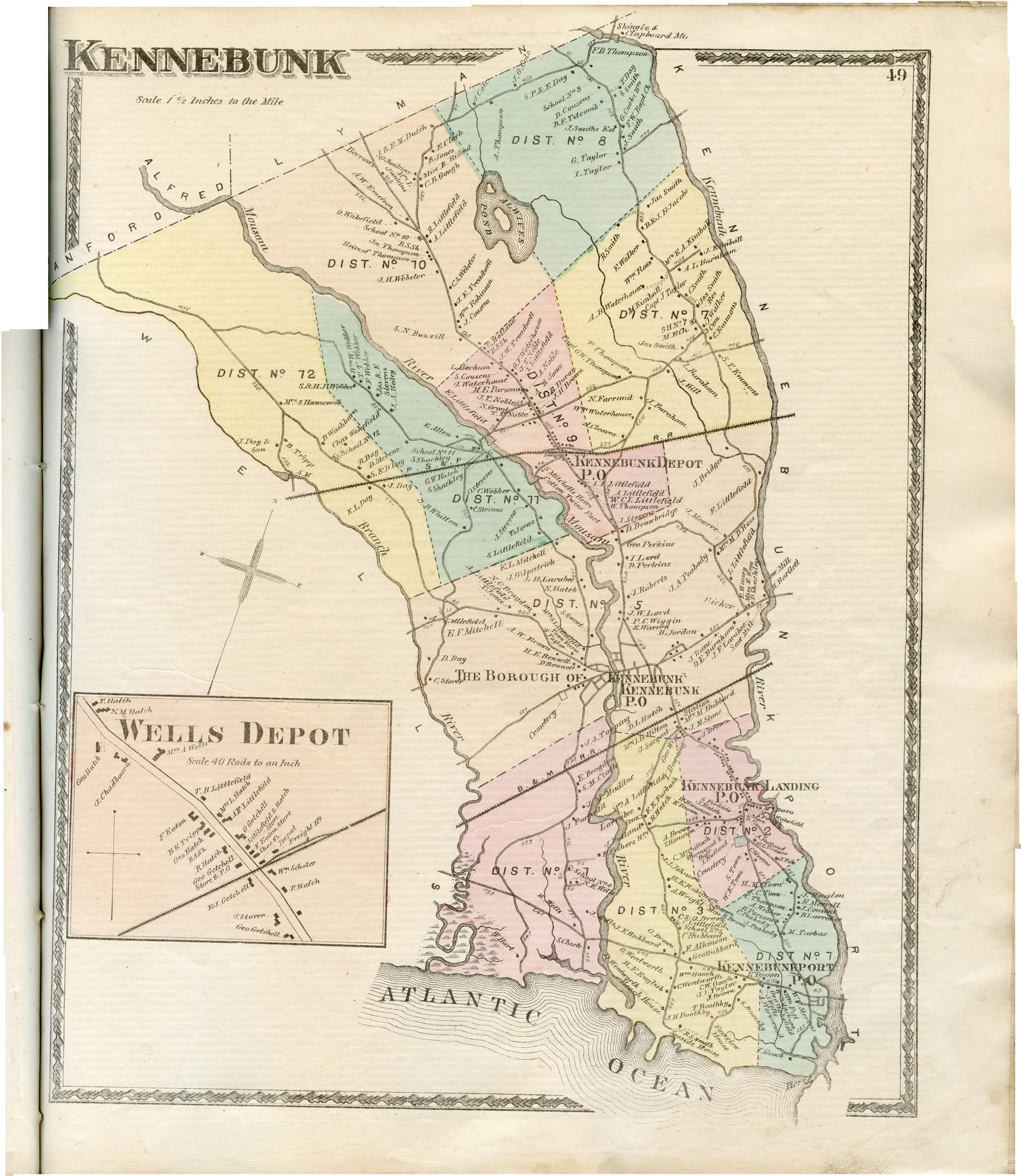
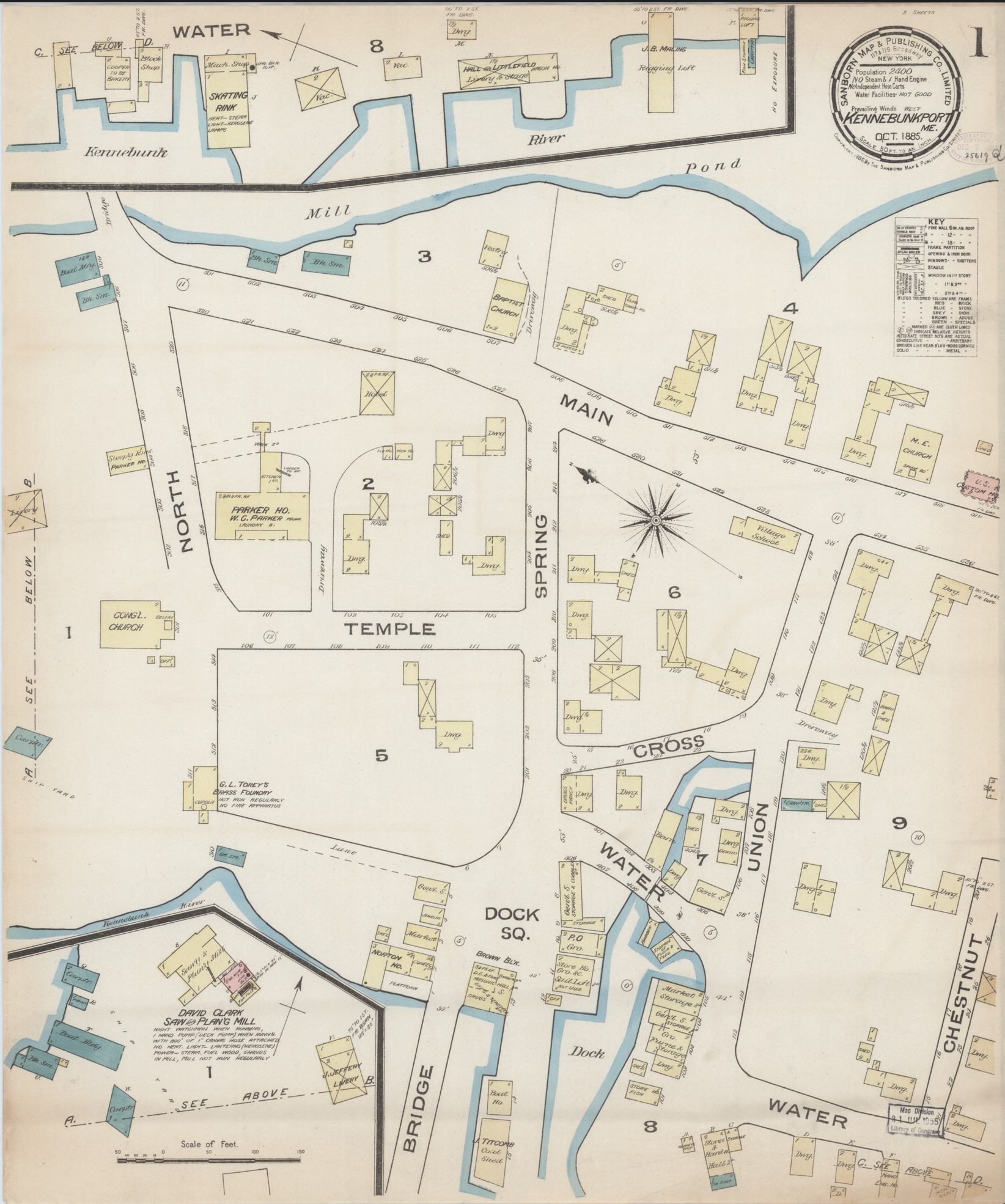
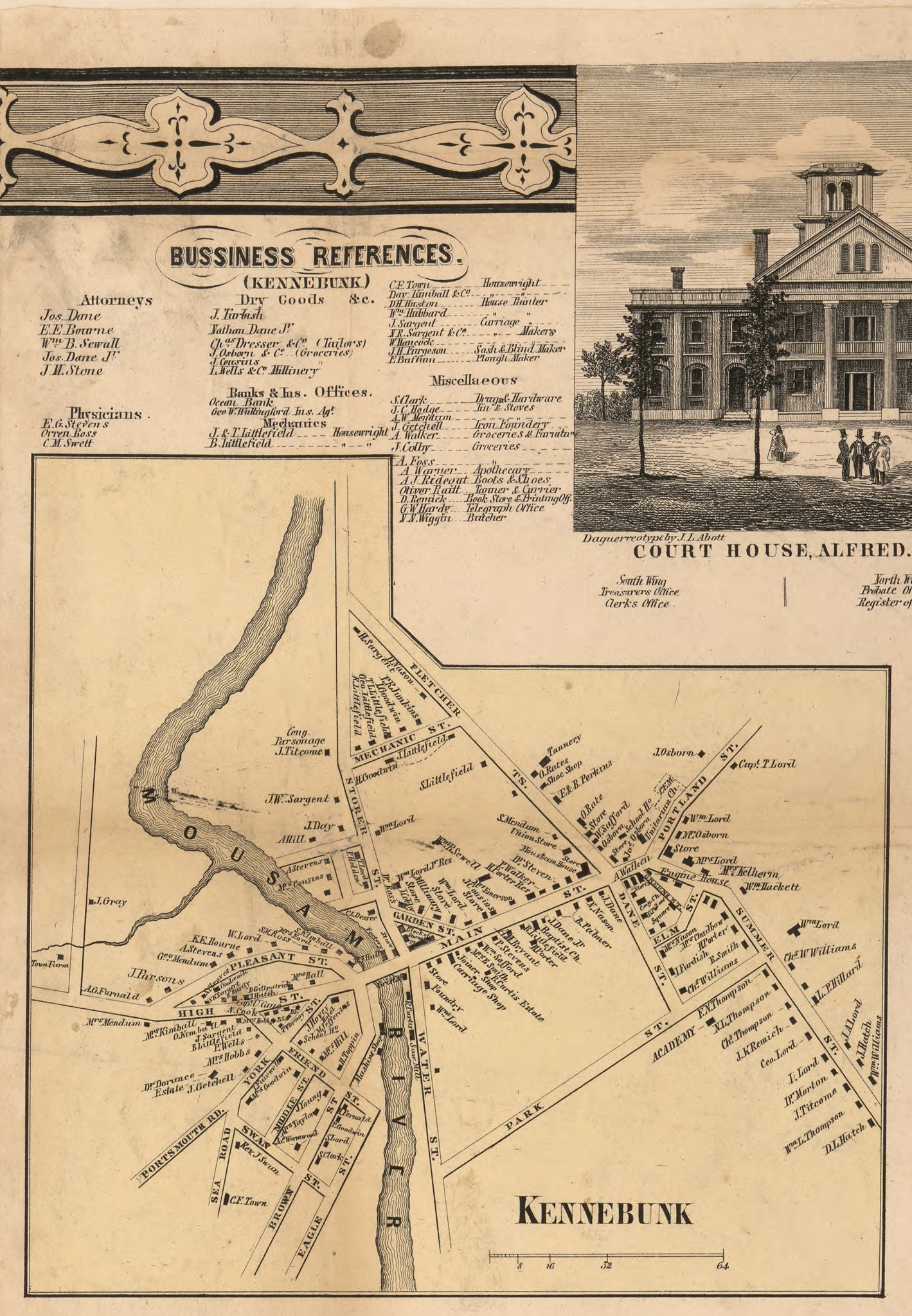
When someone calls to ask me to help them learn more about their old Kennebunkport house, the first thing I do is to look at the 1856 York County Atlas Wall Map, Sanford Everts & Co 1872 York County Atlas Map, and our handmade WWII Kennebunkport Warden’s Map of their neighborhood to learn who lived in their house during those time periods. The various years of Sanborn Insurance maps provide information about the structure itself, including the number of stories, materials, orientation, etc. during that particular year. If it is a Cape Arundel or Kennebunk Beach property, I might consult the 1890 Stuart’s Atlas. If the property is very old indeed, I refer to the maps handmade by former historians of the Kennebunkport Historical Society that I call the Decade Maps. These show property ownership in Kennebunkport between the 1640s and the 1720s.
I have named just a few of the local history maps we have in the collections of the Kennebunkport Historical Society. Over the past 2 decades I have collected originals and compiled digital versions that I keep at my fingertips at work. At home, they hang on my walls, sit as laminated placemats on the dinner table, and populate my bookcases. For this historical map lover, they provide data and juxtaposition at a beautiful glance.
We provide members of The Kennebunkport Historical Society with remote access to our digital map collection. That alone is worth the modest annual membership fee. We also sell paper and laminated copies at the archives to eat off and to hang on YOUR walls. ![]()

Leave a Reply