To the Victor Belong the Spoils
The Kennebunks have been blessed with reputable historians since European fishermen found this place sparsely populated by native families early in the 17th Century, but their versions of our stories don’t always agree 100%.
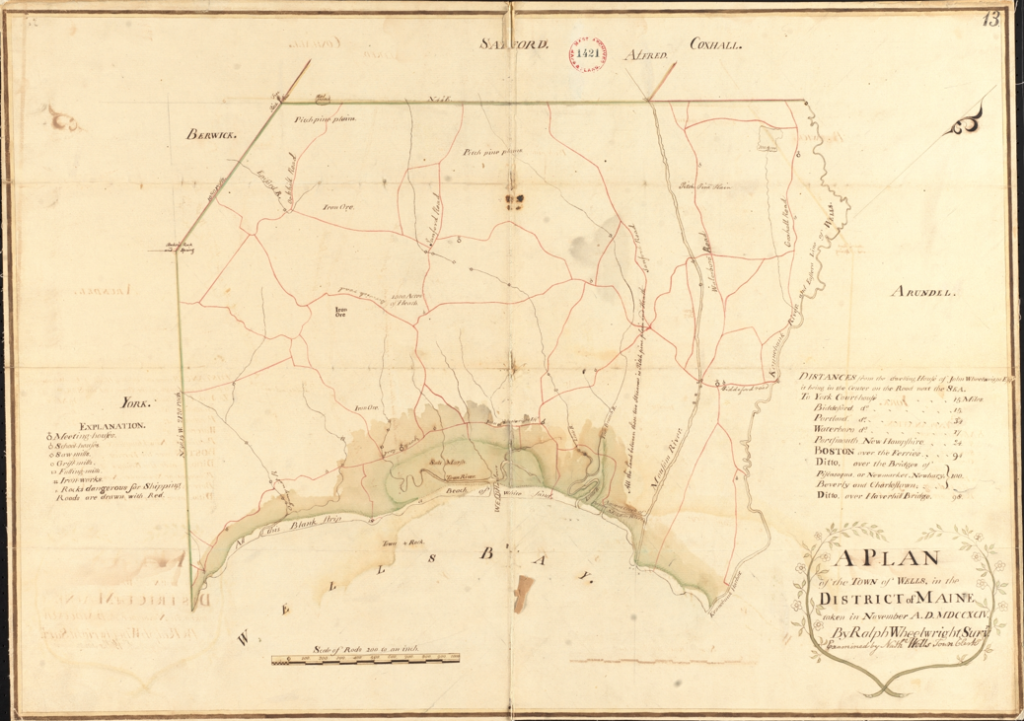
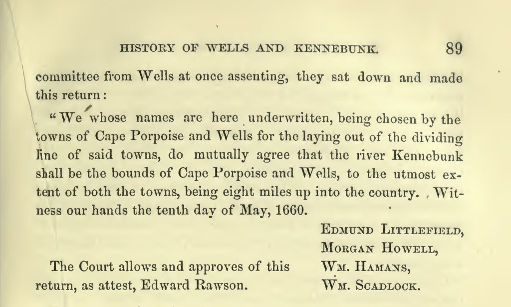
The area between the Kennebunk River and the Mousam River, which was originally called The Cape Porpoise River, was at first a kind of no man’s land. It was included on so many original grants that disagreed as to the location of the boundary between Wells and Cape Porpoise that half of its smattering of occupants had acquired their lots from one town and the other half from the other town. Finally, in 1660, Edmund Littlefield and William Hammond of Wells, and Morgan Howell and William Scadlock of Cape Porpoise formed a committee to negotiate a definite boundary line once and for all. The Wells men claimed that their town extended east to the Kennebunk River. The Cape Porpoise men believed that their town extended west to the Cape Porpoise River. The men agreed to meet at the home of the ferryman near the mouth of the Kennebunk River to hash it out.
As they all arrived at the meetingplace, a crazy May snowstorm commenced. It snowed and snowed confining the men for several days to the ferryman’s house where rum was as plentiful as it was expensive. Between sips, the Cape Porpoise men argued that the name of their town and the river at their western boundary shared the name Cape Porpoise. How could there be any dispute? The Wells men were reportedly more reserved. When the snowfall subsided, the committee had agreed that the Kennebunk River would be the boundary between their towns and that the town of Wells would pay the whole bar bill for the meeting.
Our two historians, Bradbury who penned the History of Kennebunkport and Bourne who presented the Ancient History of Kennebunk, wrote the same story in the 1830s but Bradbury wrote that the meeting took place on the eastern side of the river at Ferryman William Reynold’s house and that the boundary resolution had been suggested by the wily Wells men. Bourne wrote that the meeting was held at Ferryman Stephen Harding’s tavern on the western bank of the Kennebunk River and that the drunken Cape Porpoise men had offered up their territory because they didn’t have money enough to pay their bar bill. Let that be a lesson to us all, he seemed to say. The cautionary tale persists to this day even though Stephen Harding wasn’t even born yet in 1660.
Leave a Reply